How to draw Germany (map) with this how-to video and step by step drawing instructions. easy map drawing tutorial for beginners and children.
Please see Germany drawing tutorial in the video below
You can refer to Germany simple step by step drawing guide below
Gather Reference Material
Find a reference map of Germany to use as a guide. You can use a printed map, an image from the internet, or a digital map on your computer or tablet.
Germany is located in the center of Europe, bordering Denmark, the Baltic Sea, Poland, the Czech Republic, Austria, Switzerland, France, Luxembourg, Belgium, the Netherlands and the North Sea. Germany is located in a pivotal position between Eastern and Western Europe, between the Skandinavian peninsula and the Mediterranean.
Step 1. Draw the eastern border

The east of Germany borders Poland and the Czech Republic.
Step 2. Next draw the southern border

The south borders Switzerland and Austria.
Step 3. Western border

Next, draw Germany’s western border, adjacent to France and Luxembourg.
Step 4. Draw the coast and northern border

The north of Germany is partly bordered by the sea and Denmark.
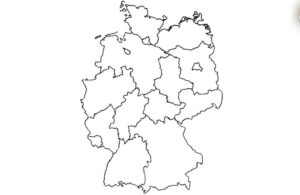
Step 5. Division of provinces
Next, divide the map you just drew into provinces and cities (need reference to accurately draw the provincial administrative boundaries).
Step 6. Complete the map and color it
Finally, color the map you just drew with suitable colors that are easy to see. If you divide the map into provinces and cities, color each administrative boundary a different color for easy identification. know.


