How to draw Canada (map) with this how-to video and step by step drawing instructions. Easy map drawing tutorial for beginners and all.
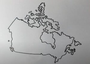
Please see Canada drawing tutorial in the video below
You can refer to Canada simple step by step drawing guide below
Canada’s territory consists of 10 provinces and 3 federal territories, stretching from the Atlantic Ocean in the east to the Pacific Ocean in the west, and bordering the Arctic Ocean in the north. Canada borders the continental United States to the south, and the US state of Alaska to the northwest.
Step 1. Draw the southern part of Canada
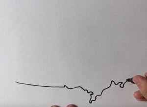
To the south of Canada is a long border with the United States with a fairly straight border.
Step 2. Draw eastern Canada
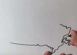
The east is adjacent to the Atlantic Ocean.
Step 3. Draw the territory north of the mainland
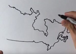
Next, draw the territory north of the Canadian mainland as many folded lines, including bays.
Step 4. Continue drawing the western border
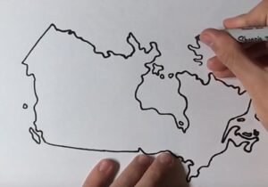
The west borders the United States and the Pacific Ocean.
Step 5. Draw large and small islands in the north
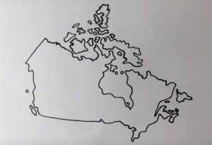
Northern Canada has many large and small archipelagos.
Step 6. color the map
Finally, color the table map you just drew with easy-to-see colors.



No Responses