How to Draw the United States (map) with this how-to video and step by step drawing instructions. There are 6 easy steps to follow, Beginners and children will enjoy designing their own United States on paper. Also included is a printable version of this United States drawing tutorial.

Please see the drawing tutorial in the video below
The United States is a federal constitutional republic in the Americas, located in the Western Hemisphere, with a territory consisting of 50 states and a federal district (including 48 continental states). The United States is located in the middle of North America, bordered by the Pacific Ocean to the west, the Atlantic Ocean to the east, Canada to the north, and Mexico to the south. The state of Alaska is located in the northwest region of the North American continent, bordered by Canada to the east and Russia to the west across the Bering Strait. The state of Hawaii is located in the middle of the Pacific Ocean. The United States has 14 dependent territories scattered throughout the Caribbean and Pacific Oceans and 326 Native American Reservations.
You can refer to the simple step by step drawing guide below
Step 1. Draw the east coast line

The eastern United States is a long coastline bordering the Atlantic Ocean.
Step 2. Continue drawing the southern territory
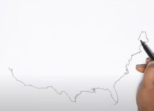
The south has a long border with Mexico and the rest is adjacent to the sea.
Step 3. Northern border
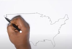
To the north is a long border with Canada with a fairly straight border on the Northwest side and quite bumpy on the Northeast side.
Step 4. Draw the western coastline
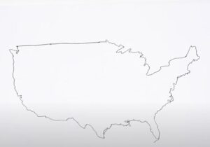
The entire western part of the mainland territory of the United States is adjacent to the Pacific Ocean with a long arc-shaped coastline.
Step 5. Draw details of the US states

Draw the states and states of the United States with 50 states.
Step 6. Finishing and coloring
You can label the US states in detail and color them. Note that contiguous states should have different colors for easy distinction.
