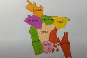
How to draw Bangladesh (map) with this how-to video and step by step drawing instructions. Easy drawing tutorial for beginners and all.
Please see the drawing tutorial in the video below
You can refer to the simple step by step drawing guide below
Materials
- Paper
- Pencil
- Eraser
- Ruler
- Colored pencils or markers (optional)
Study the shape of Bangladesh
Look at a reference map of Bangladesh to familiarize yourself with the country’s shape and main geographical features. You can find maps online or in geography books.
Step 1: Draw a basic sketch
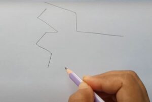
Using a pencil and ruler, lightly sketch the basic outline of Bangladesh on paper. Bangladesh has a roughly rectangular shape with a slight taper towards the southeast. Pay attention to the details of the coastline and any major rivers.
Step 2: Add details
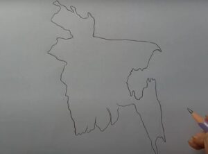
Now let’s add details of Bangladesh’s coastline, including intricate river and estuary patterns. The Ganges, Brahmaputra and Meghna are important features you may want to include.
Step 3: Draw the states and provinces of Bangladesh
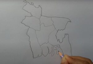
Divide the map of Bangladesh into provinces (states) so that we can easily understand the geographical location of the country of Bangladesh.
Step 4: Add finishing touches
Once you’re happy with the contours and details, use a pencil to go over the lines to darken them. Remove any unnecessary instructions or errors.
Step 5: Optional – Color your map
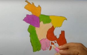
If you want, you can color your map with colored pencils or markers. For each province (state) we choose a different color to easily distinguish.
Step 6: Label important locations (provinces)

Finally, you can label the cities and provinces (states) of Bangladesh so that viewers can easily recognize them.
